Huntingdon County Information Page

Township · Huntingdon County

Cass

2 stories on file, each with its sources. 33.0 square miles of land in the ridge and valley country of central Pennsylvania.

1,018
Population
2020 Census, P.L. 94-171
32.97 sq mi
Land area
2020 Census gazetteer
Township
Type
GEOID 4206111600

The founding record

THIs township was named.in honor of Hon. Lewis Cass, of Michigan, and was erected Jan. 21, 1843. Its territory was taken from the township of Union, which had been taken from Hopewell in 1791. Penn and Union lie north of it, Shirley and Cromwell form its eastern boundary, and Clay and Tod bound it on the south and southwest. In its physical features Cass is similar to the township of Union. Jack's Mountain is on its eastern boundary, and extending in a northeasterly and southwesterly direction, parallel with this, are Clear Ridge and Sideling Hill. Between Jack's Mountain and Clear Ridge lies Hare's Valley, through which, from its central point in the township, runs Hare's Valley Creek towards the north and Three Springs Creek in a southwesterly direction. A highway runs through the township in this valley, and along this farms are scattered, though by reason of the narrowness of the valley agricultural operations are not extensive. Between Clear Ridge and Sideling Hill is Smith's Valley, which, like Hare's Valley, is traversed by a highway, and in it runs Smith's Valley Creek to the northeast from a point south of the middle of the valley in the township.. From near the same point an affluent of Three Springs Creek runs southerly, then turns to the east through Clear Ridge Gap into Hare's Valley. . J. Simpson Africa, History of Huntingdon and Blair Counties, Pennsylvania (Philadelphia: Louis H. Everts, 1883) · character 1,545,423 of the scanned text

Quoted from a work published before 1929 and therefore in the public domain in the United States. Spelling and punctuation are as printed, including nineteenth century spellings of place names. Scanned text carries optical character recognition errors; the character offset is given so the passage can be found and checked in the original.

2 stories

Stories from Cass

Did you know? Cassville went by two names at the same time for about fifty years, and the name it finally kept was picked by three men, not by the town.

Before 1797 the place was Salisbury, also known as Chilcotestown, laid out by Benjamin and Roberson Chilcote. The plan of the lots was recorded on February 22 of that year. Lots sold for twenty dollars, which the county history also gives in the old money as seven pounds ten shillings. When the village was laid out, three buildings were already standing on the site.

William Lovell kept the first tavern in the village, sometime before 1815. In 1830 Andrew Shaw and Robert Baird laid out an addition and sold lots at forty to fifty dollars each.

The move to incorporate started in 1849. The name was not put to a vote of the citizens. The county history says the present name "was selected by a committee consisting of Robert Speer, D. Stever, and D. Clarkson." The Legislature then incorporated the borough under that name on March 3, 1853.

Three men on a committee, and the name has held ever since.

What the fact check changed. DUPLICATE OF 2ebbededed917da3. No new research: this is the same post, in a near-identical copy, carrying the same defect, and it gets the same correction. ERROR MARKERS STILL PRESENT IN THIS COPY: "postal confusion", "citizens voted", "only building" This copy is NOT YET PUBLISHED, so the correction is preventive. ---- ORIGINAL VERDICT NOTES FOR THIS CORRECTION FOLLOW: THREE CLAIMS WRONG in a four sentence post. 1…

Read the full story, with 3 passages quoted from the county histories →
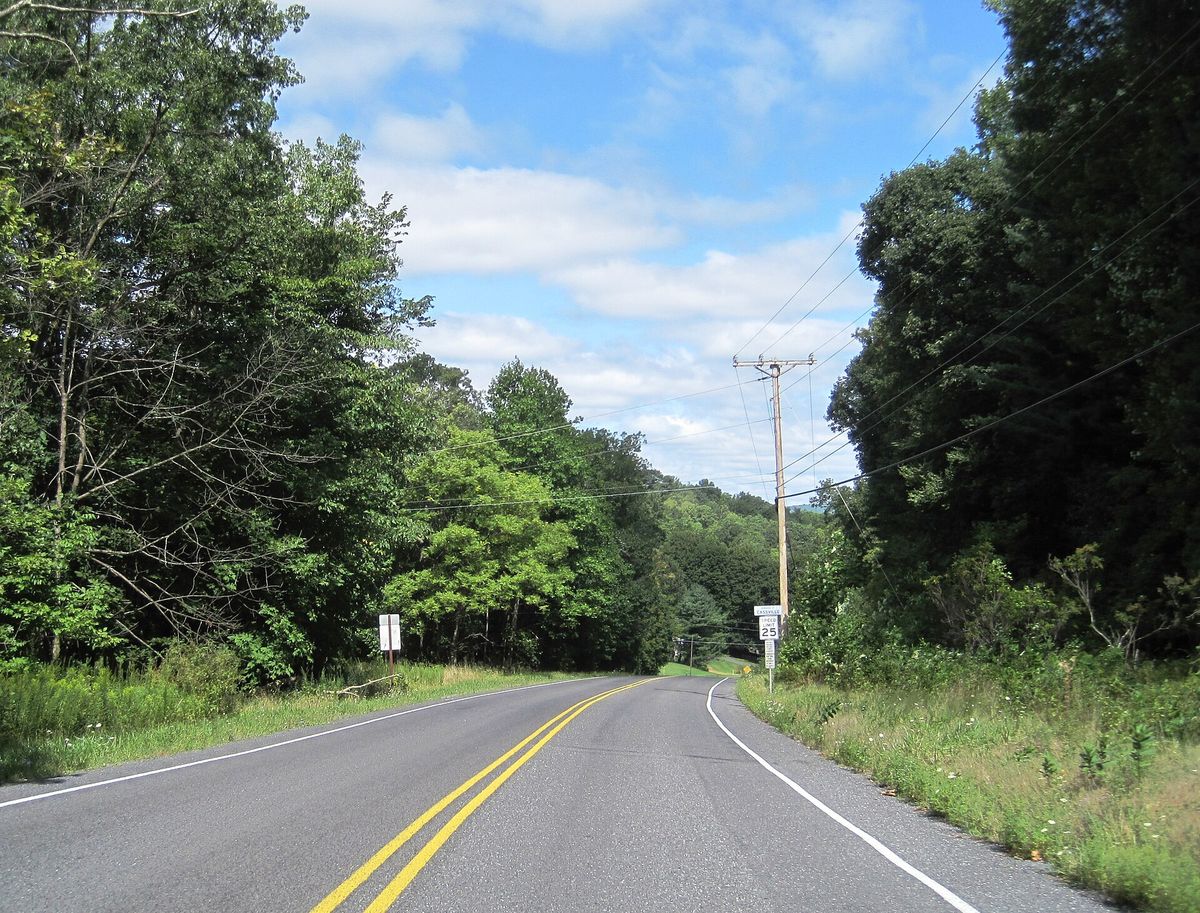
Northbound Pennsylvania Route 829 entering Cassville from Cass township, Huntingdon County, Pennsylvania
Northbound Pennsylvania Route 829 entering Cassville from Cass township, Huntingdon County, PennsylvaniaPhotograph by the Wikimedia Commons contributor Mr. Matté, 20 August 2024. Licensed CC BY-SA 4.0; reused with credit. PA 829 nb entering Cassville, Aug. 2024.jpg

Pennsylvania Route 829 running north out of Cass township towards Cassville, photographed in August 2024 between Smith Valley Road and Lucyanna Street. The camera is standing in the township, not the borough.

What the fact check changed. The file name says Cassville, which is where the road is going rather than where the photograph was taken. Its own coordinates put the camera in Cass township, and the description agrees: entering Cassville FROM Cass Township. Filed under the township.

Open this story on its own page →

Where it sits

Alexandria borough: 3 storiesBirmingham borough: 2 storiesBroad Top City borough: 2 storiesCassville borough: 2 storiesCoalmont borough: 2 storiesDudley borough: 2 storiesHuntingdon borough: 22 storiesMapleton borough: 3 storiesMarklesburg borough: 2 storiesMill Creek borough: 2 storiesMount Union borough: 131 storiesOrbisonia borough: 6 storiesPetersburg borough: 2 storiesRockhill borough: 2 storiesSaltillo borough: 2 storiesShade Gap borough: 2 storiesShirleysburg borough: 2 storiesThree Springs borough: 4 storiesBarree township: 3 storiesBrady township: 2 storiesCarbon township: 2 storiesCass township: 2 storiesClay township: 2 storiesCromwell township: 3 storiesDublin township: 4 storiesFranklin township: 2 storiesHenderson township: 4 storiesHopewell township: 2 storiesJackson township: 2 storiesJuniata township: 4 storiesLincoln township: 3 storiesLogan township: 2 storiesMiller township: 4 storiesMorris township: 2 storiesOneida township: 3 storiesPenn township: 2 storiesPorter township: 3 storiesShirley township: 5 storiesSmithfield township: 2 storiesSpringfield township: 3 storiesSpruce Creek township: 3 storiesTell township: 3 storiesTodd township: 2 storiesUnion township: 4 storiesWalker township: 4 storiesWarriors Mark township: 3 storiesWest township: 2 storiesWood township: 2 storiesHuntingdonMount UnionOrbisoniaThree SpringsPetersburgMapletonAlexandriaRockhillBroad Top CitySaltillo
10 or more4 to 91 to 3borough outline