Huntingdon County Information Page

Township · Huntingdon County

Logan

2 stories on file, each with its sources. 22.9 square miles of land in the ridge and valley country of central Pennsylvania.

611
Population
2020 Census, P.L. 94-171
22.87 sq mi
Land area
2020 Census gazetteer
0.15 sq mi
Water
2020 Census gazetteer
Township
Type
GEOID 4206144344

The founding record

Logan township was taken from West in April, 1878. As early as 1755 Barnabas Barnes secured a land warrant for a tract on the north side of the Juniata river at a place called Two Springs. In 1768 he sold that land to Rev. William Smith, the founder of Huntingdon. There is nothing to show that Barnes ever occupied the tract and the probabilities are he entered it purely for speculative purposes. Among the early settlers in this part of West township were Samuel Anderson, Jacob Neff, John Reed, Jacob Hiltzheimer, Charles Elliott, Hugh Mears, Peter Shoenbei^er, Bartholomew Maguire and the Wilsons. The first settlements were made along the Little Juniata or in the lower part of the Shaver's creek valley. When West township was divided to form Logan, the borough of Petersburg was thrown in the new township and it is the most important shipping and commercial point. John W. Jordan, ed., History of the Juniata Valley and Its People (New York: Lewis Historical Publishing, 1913) · character 193,052 of the scanned text

Quoted from a work published before 1929 and therefore in the public domain in the United States. Spelling and punctuation are as printed, including nineteenth century spellings of place names. Scanned text carries optical character recognition errors; the character offset is given so the passage can be found and checked in the original.

2 stories

Stories from Logan

From the county histories, on Logan township. The passage below is printed exactly as it appears in 1883, including the spelling of the day and the errors the scanner made. It has not been rewritten, summarised or added to.

The cloth was of Leona muslin, or lining that looked like it." The. mill was operated in the later years of the Revolution by lessees, one of whom, Peter Crum, was killed by the Indians while proceeding to his home in the present township of Logan. After 1790, Lazarus McLain was the owner of the property, but in 1795, Edward Bartholomew, of Philadelphia, became the owner, together with a large quantity of real . estate in this locality, and turned it over to his sonin-law, Greenberry P. Dorsey, who came on to live at ' this place. wee Ke Dorsey built a small forge near the mill, which was the beginning of the present Barree Iron-Works, the old mill having all this time been kept in successful operation. From the fact that the forge was situated in the old township of Barree, a name familiar to all new-comers, it received that title, and William B. Moore, "an Irishman, became the manager. Subsequently, since so many Moores were interested in the iron-works, he was distinguished from the rest by being called Barree Billy Moore. He was a very skillful workman, and the products of the forge soon became very popular with iron-workers.J. Simpson Africa, History of Huntingdon and Blair Counties, Pennsylvania (Philadelphia: Louis H. Everts, 1883) · character 2,721,230 of the scanned text

Sources

  1. J. Simpson Africa, History of Huntingdon and Blair Counties, Pennsylvania (Philadelphia: Louis H. Everts, 1883)
Open this story on its own page →

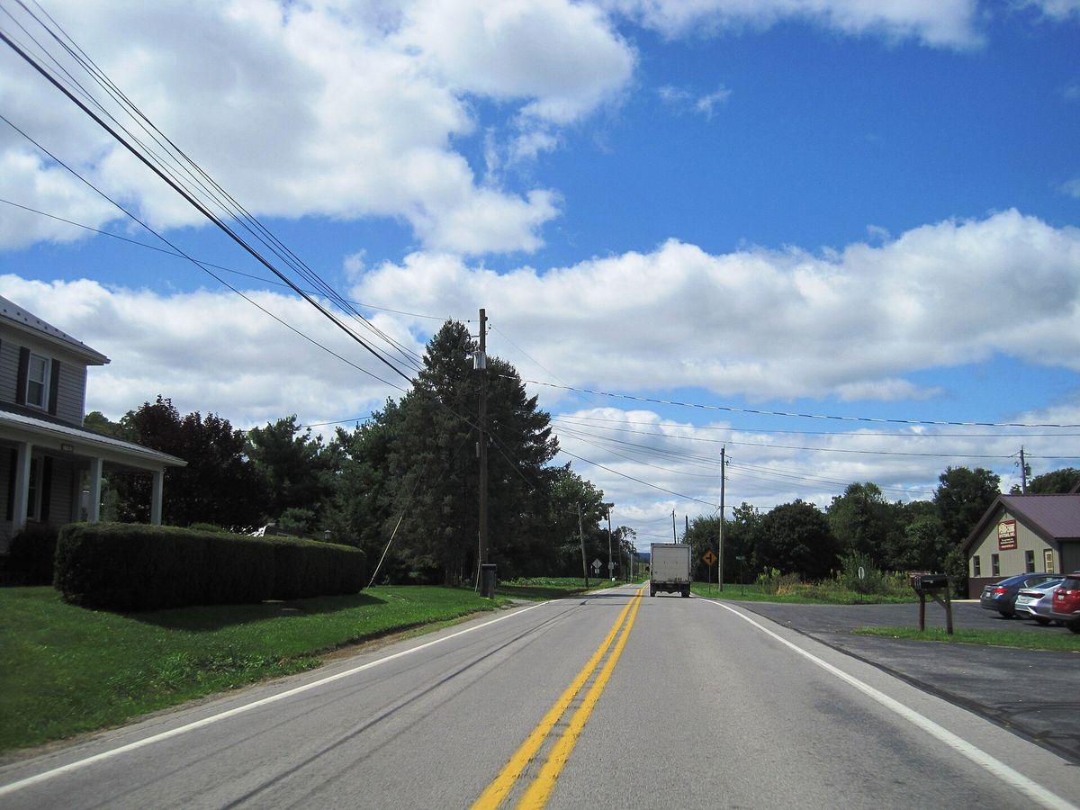
westbound Pennsylvania Route 305 (Shavers Creek Road) in the village of Ribot within Logan Township, Huntingdon County, Pennsylvania. Photo taken looking south-southwest between McMahon Road and Mill Road.
westbound Pennsylvania Route 305 (Shavers Creek Road) in the village of Ribot within Logan Township, Huntingdon County, Pennsylvania. Photo taken looking south-southwest between McMahon Road and Mill Road.Photograph by Mr. Matté, 2024-08-20. Licensed CC BY-SA 4.0; reused with credit, and the same licence travels with any derivative. PA 305 wb in Ribot, Aug. 2024.jpg

Shavers Creek Road, which is also Pennsylvania Route 305, running west through the village of Ribot in Logan township. Photographed in August 2024.

What the fact check changed. Placed by the photograph's own coordinates against the Census geocoder, which returns Huntingdon / Logan / .

Open this story on its own page →

Where it sits

Alexandria borough: 3 storiesBirmingham borough: 2 storiesBroad Top City borough: 2 storiesCassville borough: 2 storiesCoalmont borough: 2 storiesDudley borough: 2 storiesHuntingdon borough: 22 storiesMapleton borough: 3 storiesMarklesburg borough: 2 storiesMill Creek borough: 2 storiesMount Union borough: 131 storiesOrbisonia borough: 6 storiesPetersburg borough: 2 storiesRockhill borough: 2 storiesSaltillo borough: 2 storiesShade Gap borough: 2 storiesShirleysburg borough: 2 storiesThree Springs borough: 4 storiesBarree township: 3 storiesBrady township: 2 storiesCarbon township: 2 storiesCass township: 2 storiesClay township: 2 storiesCromwell township: 3 storiesDublin township: 4 storiesFranklin township: 2 storiesHenderson township: 4 storiesHopewell township: 2 storiesJackson township: 2 storiesJuniata township: 4 storiesLincoln township: 3 storiesLogan township: 2 storiesMiller township: 4 storiesMorris township: 2 storiesOneida township: 3 storiesPenn township: 2 storiesPorter township: 3 storiesShirley township: 5 storiesSmithfield township: 2 storiesSpringfield township: 3 storiesSpruce Creek township: 3 storiesTell township: 3 storiesTodd township: 2 storiesUnion township: 4 storiesWalker township: 4 storiesWarriors Mark township: 3 storiesWest township: 2 storiesWood township: 2 storiesHuntingdonMount UnionOrbisoniaThree SpringsPetersburgMapletonAlexandriaRockhillBroad Top CitySaltillo
10 or more4 to 91 to 3borough outline